




[Main Island of Okinawa] 10 Day-Trip Hiking Spots Perfect for Beginners!

What Makes Mountain Climbing and Hiking on Okinawa's Main Island So Appealing?

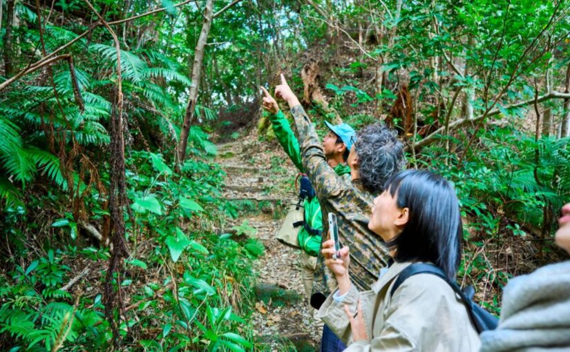
While Okinawa is often associated with blue seas, you can actually discover breathtaking tropical scenery and wildlife in its lush, green mountains as well.
In this article, we'll introduce hiking spots on Okinawa's main island that even beginners can enjoy on a day trip.10 locationsWe’ve carefully selected these to share with you.
◆For those who want to learn about Okinawa-specific measures for dealing with habu snakes
◆For those who want to enjoy not only the ocean but also nature on their trip to Okinawa
◆For those looking for hiking spots suitable for beginners
Click here to see the ranking of popular tours in Okinawa
[Top 10 Picks] Okinawa Main Island
Day-Trip Hiking and Walking Spots

In this section, we’ll introduce 10 hiking spots on the main island of Okinawa that even beginners can enjoy with confidence, along with information on how to get there and their key features.
▼Click here for recommended mountain climbing and hiking itineraries▼
![Yanbaru Walking/2.5 hours] Trekking tour to "Mt. Nekumachiji," the highest peak in Ogimi Village☆Overlooking the World Heritage forest and the Churaumi Sea! Beginners OK♪ (No.237)](https://okinawatour.world-tours.jp/wp-content/uploads/2024/04/a98b1120712ae2558c294773114e59b3-825x510.jpg)
Mt. Nago (Nago City)
Mt. Nago has an elevation of345 metersIt is a mountain of that size and has been designated as part of the Okinawa Coast Quasi-National Park and a wildlife sanctuary.
More than 200 species of plants and 50 species of birds have been identified here, so you can enjoy observing wildlife unique to Okinawa.
From the Nago Youth Center, which serves as the trailhead, there are several trails to choose from, so everyone from beginners to experienced hikers can find a route that suits them.
From the mountaintop, you can enjoy a panoramic view of Nago City and the ocean—a view that will give you a real sense of accomplishment.
Access: 1 hr. 30 min. by car from Naha Airport
Elevation: 345.2 m
Hiking time: About 3 hours
Mt. Yonaha (Kunigami Village)
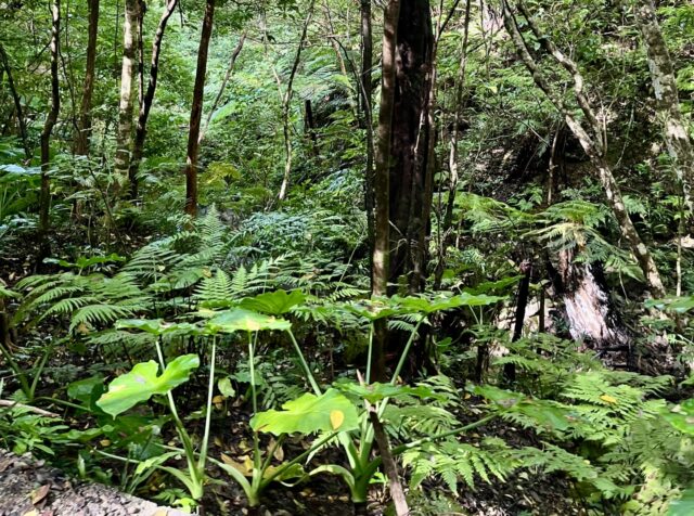
Mount Yonaha has an elevation of 503 meters and is located on the main island of Okinawa,The Highest PeakIt is a mountain known as [...].
Located within Yanbaru National Park, you might encounter rare animals such as the Yanbaru rail and the Noguchi's woodpecker.
There's a somewhat steep slope near the entrance, but once you get past that, the path becomes gentle all the way to the summit, so the second half of the hike is easy to walk.
Please keep in mind that access to certain areas near the summit is restricted in order to protect the rare natural environment.
Access: 2 hours by car from Naha Airport
Elevation: 503 meters
Hiking time: About 2 hours
A car is the best way to get around Okinawa!
Click here for recommended car rental plans



▼Click here for more details on our car rental plans▼

Mt. Yaedake (Motobu Town)

Mount Yaedake stands at an elevation of 453 meters and is the second-highest mountain on the main island of Okinawa, after Mount Yonaha.
Along the path leading to the summit, there are more than 7,000Winter-Red Cherry Blossom(Kanhi-zakura) cherry trees are planted there, and it’s famous as the site of Japan’s earliest cherry blossom festival.
Another attraction is that, thanks to the well-maintained roads, you can drive almost all the way to the summit.
If you visit during the blooming season, you can enjoy both the early-blooming cherry blossoms—a hallmark of the tropics—and the breathtaking scenery.
Access: 1 hour and 40 minutes by car from Naha Airport
Elevation: 453.4 m
Hiking Time:Approx. 3 hours
Mt. Katsuo (Nago City)
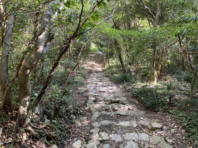
Mount Katsutake is a mountain with an elevation of 452 meters and is located within a designated nature preserve.
1 hour one waySince it's easy to climb, it's a popular hiking spot for beginners.
From the mountaintop, you can look out over the city of Nago, and the unique landscape featuring expansive, cone-shaped karst formations is also a highlight.
It’s also well-known as a great spot for photos, so why not bring your camera and check it out?
Access: 1 hr. 30 min. by car from Naha Airport
Elevation:452 m
Hiking time: About 1 to 2 hours
▼Click here for recommended mountain climbing and hiking itineraries▼
Mt. Furusato (Nago City)
Mt. Furusato is a mountain with an elevation of about 391 meters, located slightly south of Mt. Katsuo.
Around mid-March,Shikuwasa OrchardYou can enjoy hiking while surrounded by the refreshing scent of the blooming flowers.
Since there are some slightly rugged limestone sections along the hiking trail, we recommend wearing sturdy shoes.
This route is popular even among experienced hikers, some of whom enjoy traversing the surrounding mountains as part of a longer trek.
Access: 1 hr. 30 min. by car from Naha Airport
Elevation:391 m
Hiking Time:Approx. 2 hours
Mt. Ishikawa (Uruma City)
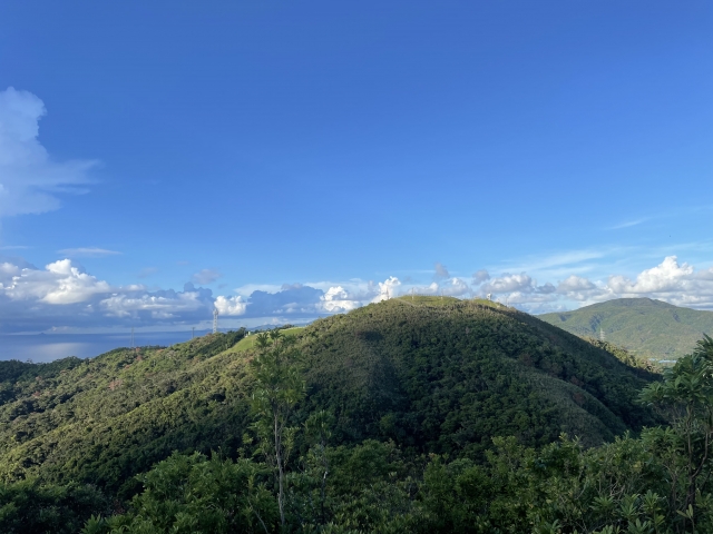
Mount Ishikawa has an elevation of204 mAlthough it is a relatively low mountain, it is a lush, green spot that has been selected as one of Japan’s Top 100 Forest Bathing Spots.
There are three courses—A, B, and C—and we recommend Courses A and B for beginners and Course C for experienced players.
From the mountaintop, you can see both the Pacific Ocean and the East China Sea, and the appeal lies in being able to enjoy both bodies of water at once.
It’s easily accessible from Naha, making it a great spot to casually experience Okinawa’s mountains.
Access: 1 hour and 10 minutes by car from Naha Airport
Elevation: 204 m
Hiking time: About 3 hours
You can take it from Naha Airport!
Click here for recommended car rental plans


▼Click here for more details on our car rental plans▼
Mt. Kugani (Ogimi Village)
Mt. Kugani is a mountain with an elevation of about 280 meters, and together with Mt. Shioya Fuji and Mt. Nekumachiji,TraverseIt's a spot that's often visited.
As you follow the trail surrounded by the Yanbaru Forest, you’ll be able to see the coastline of northern Okinawa Island from the ridgeline.
Rather than being climbed on its own, it is popular as part of a trekking route that takes hikers around several mountains.
If you're confident in your physical fitness, we recommend spending a full day hiking the ridge along with the surrounding mountains.
Access: 1 hour and 45 minutes by car from Naha Airport
Elevation: 287 m
Hiking time: About 1.5 hours
Mount Anwa (Nago City)
Mount Anwa is a mountain with an elevation of 432 meters, located at the base of the Motobu Peninsula.
Locally, it's known as “Honshu AlpsIt's also known as [...], and from the ridgeline, you can see what is said to be Japan's only conical karst formation.
Shikuwasa orchards stretch out at the foot of the mountain, and another distinctive feature is the short distance from the mountain to the sea.
Since there are some sections with fairly steep inclines, this trail is best suited for hikers with some experience.
Access: 1 hr. 30 min. by car from Naha Airport
Elevation: 432 m
Hiking time: About 3 to 3.5 hours
▼Click here for car rental plans recommended for large groups▼


▼Click here for more details on our car rental plans▼
Oishi Rinzan (Kunigami Village)

Oishi Rinzan (Asumui Hikes) is a landscape formed by Ryukyu limestone in an area at an elevation of around 100 metersKarst topographyIt is a scenic spot.
There are several walking trails available, such as the "Mega-Rocks and Stone Forest Scenic Trail" and the "Beautiful Sea Observation Deck Trail."
Each course takes about 30 to 60 minutes to walk, so even those who aren't confident in their physical fitness can easily enjoy nature.
It is also known as a sacred site associated with Okinawa’s creation myth and is a place where you can experience a mysterious atmosphere.
Access: 2 hours 15 minutes by car from Naha Airport
Elevation: 204 m
Hiking time: About 1 to 2 hours (depending on the trail)
Hiji Otaki Hiking Trail (Kunigami Village)

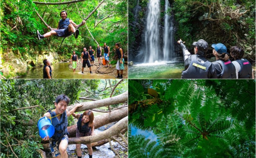
The Hiji Otaki Waterfall has a drop of25.7 mIt is one of the largest waterfalls on the main island of Okinawa.
There's a well-maintained walking trail from the campground to the waterfall that takes about 40 to 60 minutes one way, and it's popular with beginner hikers and families with children.
Along the way, there are suspension bridges and areas where you can play in the river, so you can fully enjoy the natural beauty of Yanbaru.
The walk to the waterfall, where you can soak up negative ions, is the perfect way to refresh yourself.
Access: 2 hours by car from Naha Airport
Hiking time: About 40–60 minutes
▼Click here for recommended plans to enjoy waterfalls▼


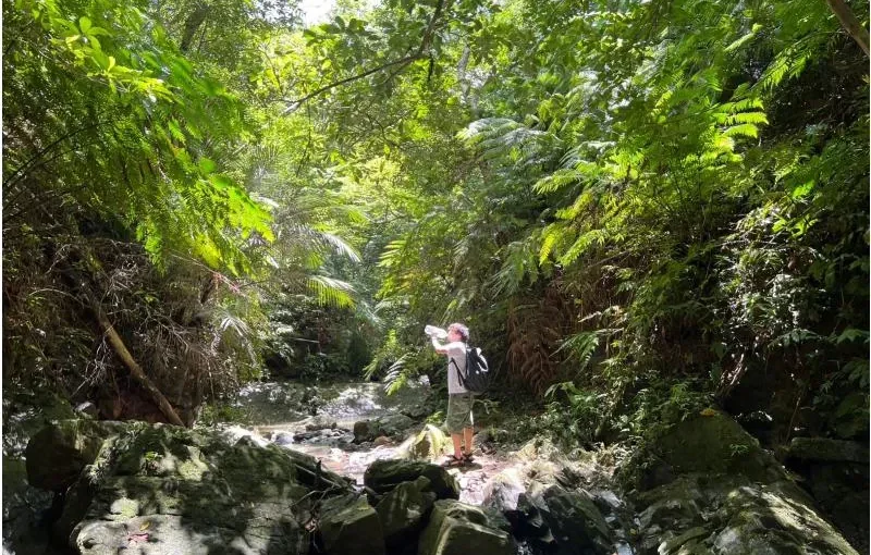
Precautions Against Habu Snakes When Hiking in Okinawa
When hiking in the mountains of Okinawa, one thing you absolutely must be aware of is venomous snakes.hubThese are measures to address that.
If you're prepared with the right knowledge, you can enjoy hiking without worrying too much.
Precautions Regarding Clothing and Personal Belongings

To avoid exposing skin,Long sleeves and long pantsLet's wear them.
We recommend wearing sturdy hiking boots or rubber boots.
Be careful not to reach into grassy areas or crevices between rocks, and it’s safer to walk while checking the ground ahead with your trekking poles.
Since they become more active after sunset, it’s important to go out early in the day.
What to Do If You Are Bitten

If you are bitten, stay calm and keep the affected area below the level of your heart.
Since running can cause the poison to spread more easily throughout your body, it’s important to walk slowly down the mountain.
Right away119Please contact them and receive serum therapy at a nearby hospital.
Before heading out on a hike, it’s a good idea to check for information on habu snake habitats and emergency contact numbers.
▼Click here for recommended bus tours for your Okinawa trip▼


▼Click here for more details on day-trip bus tours▼

How to Choose Spots for Beginners

If you're hiking in Okinawa for the first time, you'll have fewer mishaps if you keep a few key points in mind when choosing a spot.
Choose by Elevation and Travel Time

For beginners, the elevationAbout 300 metersWe recommend starting with a hike that takes about 2 hours.
Mount Katsunou and Mount Ishikawa, which we introduced here, are easy hikes even for those who aren't confident in their physical fitness.
Once you get the hang of it, why not try climbing a tall mountain like Mt. Yonaha?
▼Click here for tours to Okinawa's power spots▼
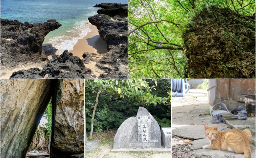


Choose Based on Ease of Access

rent-a-carIf you have one, you can easily access many locations from the parking lot.
If you plan to use public transportation, be sure to check in advance, as bus service may be limited in some areas.
If you choose a spot close to Naha, you can minimize travel time and enjoy a more relaxed experience.
Choose by Scenic Spot

The Sea and the MountainsIf you want to enjoy both at the same time, Mount Ishikawa and Mount Anwa are highly recommended.
If you want to enjoy the cherry blossoms, Mount Yaedake is the perfect choice, and if you're interested in karst landscapes, Mount Oishirin is the way to go.
Choosing a spot that suits your goals will make for a more satisfying hiking experience.
Information on Mountain Climbing and Hiking on the Main Island of Okinawa
Frequently Asked Questions (FAQ)
The most important precaution is to protect yourself against the habu, a venomous snake. Wear long sleeves and long pants, and avoid carelessly reaching into grassy areas or crevices between rocks. If you are bitten, stay calm, keep the affected area below the level of your heart, and call 119 immediately.
Mount Katsuo, which takes about an hour to climb one way, and Mount Ishikawa, at an elevation of 204 meters, are both recommended for beginners. The Hiji Otaki Waterfall Trekking Course and Mount Oishi Rinzan, both featuring well-maintained walking trails, are also great spots to enjoy nature at your own pace.
Long-sleeved shirts, long pants, and sturdy hiking shoes are essential. Don’t forget to bring insect repellent, drinks, and a hat. Hiking poles can also be helpful for checking the ground ahead.
summary

Okinawa Main Island offers not only the ocean but also plenty of attractive spots for mountain climbing and hiking.
All 10 of the mountains featured here are perfect for beginners to enjoy on a day trip.
Countermeasures Against HubsWhy not enjoy the breathtaking scenery and encounters with wildlife unique to the tropics while making sure to follow all safety precautions?
▼Click here for articles to read in conjunction with this one.